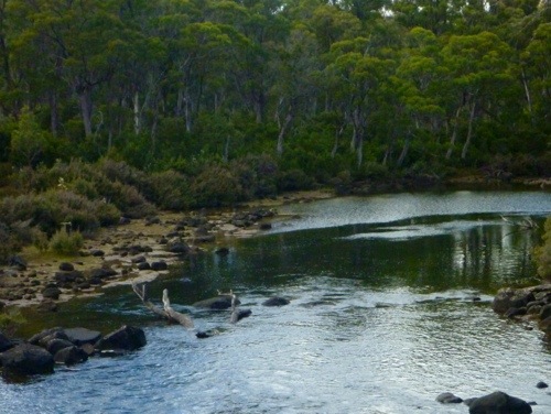
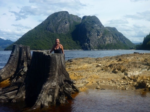
Archive | Tasmania RSS feed for this section
February 14, 2013

Esperance River

From Hobart we want to go as south as possible along the east cost as we can on bitumen road. Marjo has listed things we want to see and the Tahune Airwalk is one of those things. We arrive at the information centre and find out that its not easy to do with the dog as it involves metal grates that are not compatible with dog paws. Instead we decide to go there and do part of the walk and just enjoy the scenery. The friendly assistant even helped us with advising a camp site along a river that we could kayak.

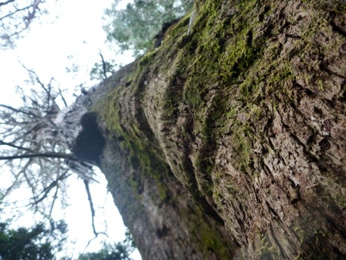
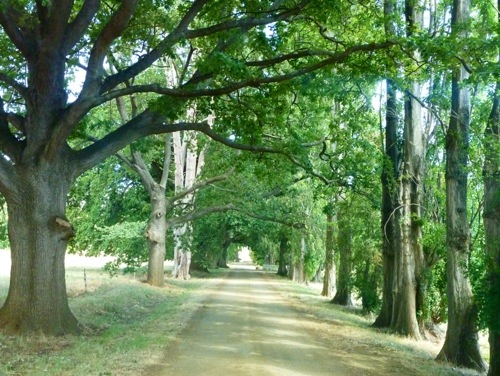
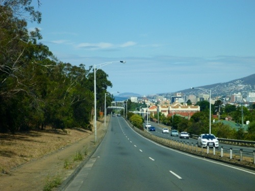
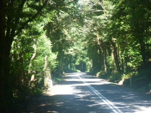
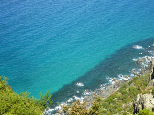
The road is nice but relatively busy; the Tahune Airwalk has no lack of visitors. We also find that the east coast is considerably more popular with tourists and we see many caravans, but also bus loads of tourists from Hobart.

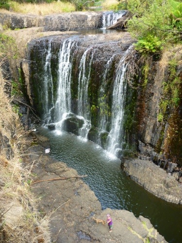
We stop at every possible location along the road and enjoy small walks and views.

20130213-174419.jpg

20130213-174431.jpg

20130213-174448.jpg

20130213-174524.jpg

20130213-174536.jpg

20130213-174613.jpg

20130213-174624.jpg

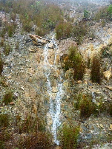
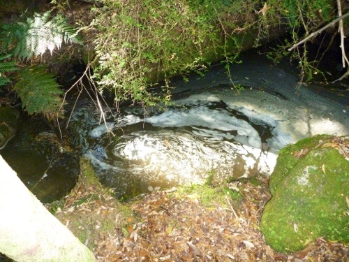
The camp site along the river is not really nice, it is just along a gravel road to a gravel pit. Also the river is too shallow to kayak; the dry summer in Tasmania has definitely had its impact on the water in all the rivers.

20130213-174917.jpg
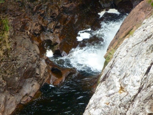
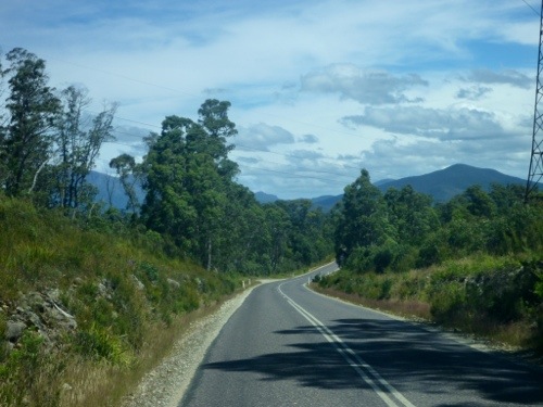
After we check out the end of the Tahune Airwalk, we decide to drive back to the coast and more south.

20130213-175038.jpg

20130213-175048.jpg

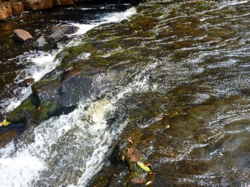
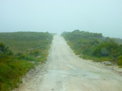
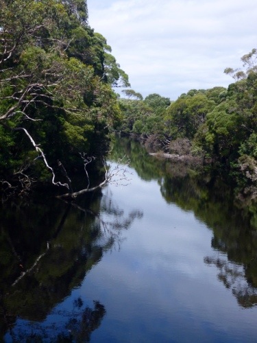
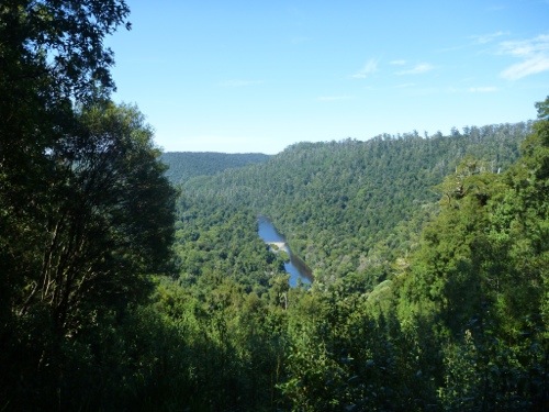
There we take a nice dirt road towards the Esperance river and hope for a good camp spot. And we find it along the river.

20130213-175217.jpg

20130213-175229.jpg

We all seem to like it.

20130213-175310.jpg

20130213-175321.jpg

20130213-175329.jpg

20130213-175351.jpg

Apart from a grumpy couple that treated the large camp site along the river as it was their exclusive location. When we arrived they were away and we set up more than 25 meters away, hidden behind a bush. When they returned they muttered about privacy, and how we could park here and they promptly packed up and left. Must have thought that camping at nice spots is something you don’t share. Odd.

20130215-095157.jpg
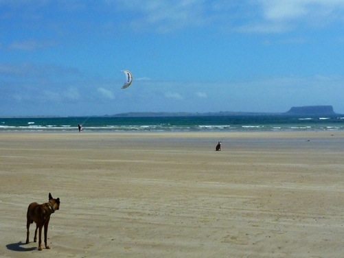
The space they left behind (left of Nossi), if you look closely you can see on the right of Nossi our bus behind the bushes.

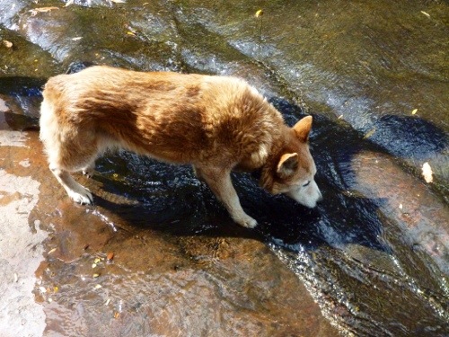
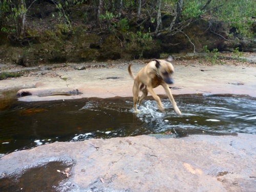
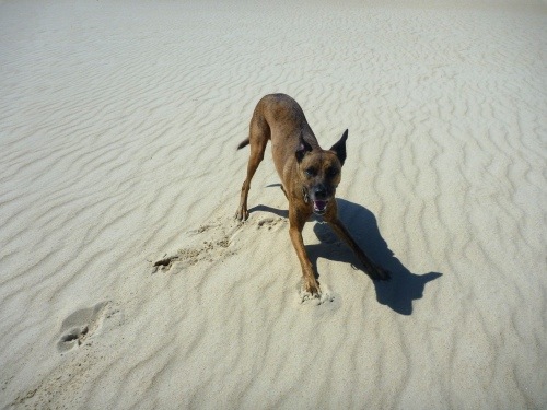
Well, Dotti was not impressed by all this.

20130213-175703.jpg
If they don’t like it, well tough luck.

20130213-175748.jpg
She wasn’t too sad when they left.

20130213-202810.jpg

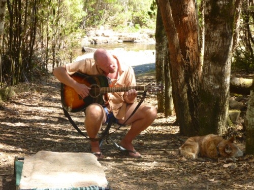
That evening we shared a drink with the locals.

20130213-202854.jpg

20130215-092759.jpg

We decided to stay for a couple of days and filled our time playing guitar
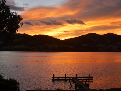
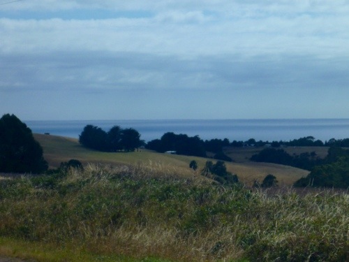
20130215-095536.jpg
enjoying the view

20130215-095637.jpg
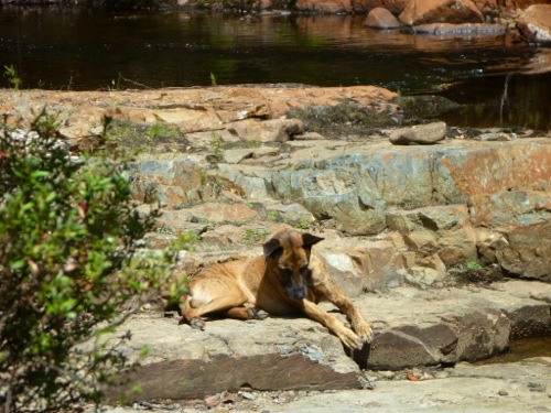
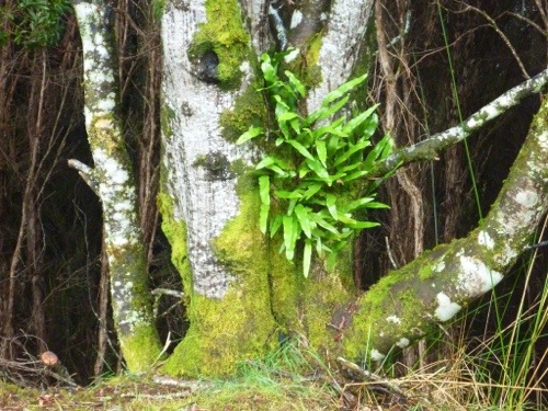
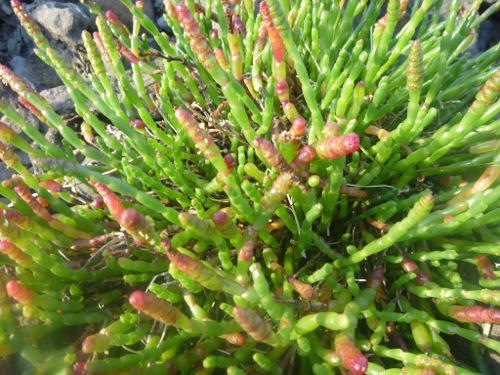
basking in the sun like the ferns

20130215-095835.jpg

20130215-095842.jpg
drinking coffee with Peter the Park Ranger and getting firewood in return

20130215-095936.jpg

20130215-095949.jpg
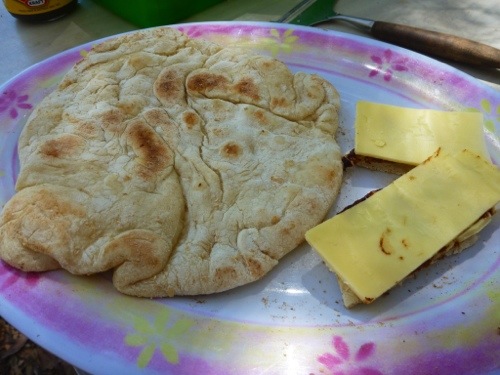
baking bread and eating it for lunch

20130215-100024.jpg

20130215-100041.jpg
using the river as Eco friendly washer

20130215-100116.jpg
and acrobatics.

20130215-100155.jpg

20130215-100208.jpg

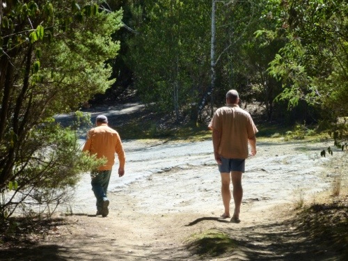
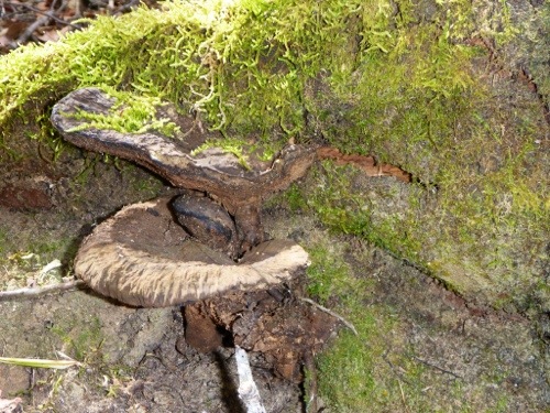
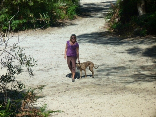
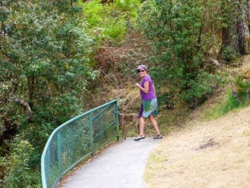
Of course Marjo and Nossi went exploring on walks along the river.

20130215-100254.jpg

20130215-100302.jpg

20130215-100313.jpg

20130215-100321.jpg

20130215-100345.jpg

And in the evening we made good use of the firewood.
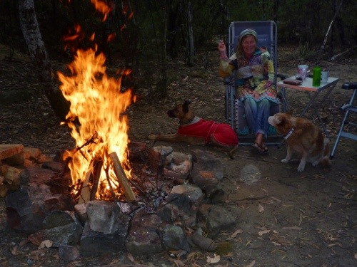
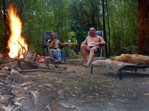
20130215-101117.jpg

20130215-101132.jpg

20130215-101142.jpg

A magical spot.

20130215-101209.jpg

February 14, 2013

Happy Valentine

Marjo made this from ochre, leaves and white sand on a small patch of moss.
20130215-092759.jpg

February 11, 2013

Shipwrights Point Regatta

From Wayatinah we get closer to the east coast. This becomes evident in the changing landscape.

20130213-171353.jpg

20130213-171410.jpg

Suddenly we also notice that the bush fires in Tasmania have not all been extinguished. Up to now we have not seen any signs of burnt bush.

20130213-171547.jpg

20130213-171557.jpg
But here it is quite evident that fire came very close to properties. The black scorched earth is no shadow but burnt grass.

20130213-171619.jpg

We stop at various spots along the road, once to look at how they grow hop (always interesting to learn how beer ingredients are grown).

20130213-171854.jpg

And once to buy a $2 bag of white flesh peaches.

20130213-171952.jpg

And once to look at an old bakery cum whiskey distillery cum salmon pond. It was an old farm where the grandfather had a variety of interests and turned them into a profitable business. At some point he had 100 staff. Now it was a couple who bought the place and tried to restore it to its former glory. Unfortunately they couldn’t demonstrate the whiskey making, the oven couldn’t be lit because the smoke could scare bushfire jittery neighbours and the salmon pond was sold. So we just had a nice chat and looked around at the property.

20130213-172316.jpg

20130213-172331.jpg

20130213-172357.jpg

Then we arrived at Hobart and although it’s nothing compared to Sydney, Melbourne or Perth, it is still noticeable more busy then anywhere we’ve seen sofar on Tasmania.

20130213-172545.jpg

20130213-172603.jpg

And it got even busier near the foreshore where the annual Regatta was in full play.

20130213-172721.jpg

20130213-172747.jpg

We skipped the first campsite south of Hobart as everyone seemed to congregate there and selected for the foreshore campground in Port Huon.

20130213-172907.jpg

Apart from an awesome partner, friend, artist and cook, Marjo also seems to have a inbuilt clock that allows her to capture a nice sunset.

20130213-173551.jpg
As well as the sunrise.

20130213-173646.jpg

20130213-173728.jpg

20130213-173740.jpg

A great day.

20130213-173802.jpg

Posted from Port Huon, Tasmania, Australia.

February 10, 2013

Wayatinah Lagoon

We woke up with more rain, lucky drizzle this time. We pack up and head further south east.

As soon as we are on the road the clouds open.

20130213-125503.jpg
And soon the sun comes out to steam dry the roads.

20130213-125541.jpg

The road takes us through a national park and gives us nice views of streams and bush.

20130213-125921.jpg

20130213-130125.jpg

20130213-130137.jpg

20130213-130150.jpg

20130213-130159.jpg

20130213-130225.jpg

Then we come to Wayatinah dam, which is the end of a complex structure of dams and power generation.

20130213-134044.jpg

20130213-134120.jpg

20130213-134131.jpg

20130213-134147.jpg

We decide that it’s time to do our laundry and have a proper hot shower and pull into the caravan park. Someone must have decided that it was not nice to have big trees in the dam.

20130213-135125.jpg
And clearly couldn’t be bothered to remove the tree stumps after cutting them all down.

The recent rain made the surroundings all soggy so access to the water’s edge led to brown socks.

20130213-135617.jpg

It was nice and quiet though and we were able to do all the laundry, take nice showers and had a good time. We didn’t try out the nice big pool after we saw that most kids and adults were wearing full wetsuits. We assume the temperature was not very appealing.

A nice day.

20130213-135831.jpg

Posted from Port Huon, Tasmania, Australia.

February 9, 2013

Lake Burbury East Foreshore

As soon as we packed up at Macquarie Heads it started to rain. The howling wind made it a horizontal rain and we left the hordes of quad bikers clad in yellow wet weather gear and took the 11 km of corrugated road back.

20130212-213734.jpg

We visited the historic place called Queenstown and it has not much to offer. It’s clearly a mining town that has lost most of its glory.

20130212-213937.jpg

20130212-213950.jpg

20130212-214003.jpg
On leaving town we saw a bright spot along the road that made us smile, despite the heavy rain.

20130212-214059.jpg

Leaving town, the road went steeply up a hill and gave a watery view of town.

20130212-214219.jpg

20130212-214233.jpg

The wet rock face made for some pretty pictures.

20130212-214309.jpg

20130212-214338.jpg

20130212-214348.jpg

20130212-214402.jpg

20130212-214415.jpg

And some mini waterfalls.

20130212-214521.jpg

20130212-214535.jpg

The lookout wasn’t as spectacular as we thought.

20130212-214645.jpg

20130212-214724.jpg

So we went down hill again.

20130212-214814.jpg

20130212-214858.jpg

We decided to go to the next nearest campsite and read a book in the bus.
When the rain stopped for half an hour it was time to walk the dogs.

20130212-215035.jpg

20130212-215051.jpg

20130212-215104.jpg

20130212-215115.jpg

20130212-215127.jpg

A lazy day.

20130212-215211.jpg

Posted from Port Huon, Tasmania, Australia.

February 8, 2013

Macquarie Heads

Leaving Mackintosh dam was not easy and with hindsight we should have stayed longer. But we didn’t. Slowly we packed up and moved down hill closer to the west coast.

20130212-204728.jpg

20130212-204742.jpg

Along the road we stopped at various falls, one nicer than the other.

20130212-204915.jpg

20130212-205000.jpg

We also passed a Magnetite mine. Magnetite is the most magnetic of all the naturally occurring minerals on Earth. Naturally magnetized pieces of magnetite, called lodestone, will attract small pieces of iron, and this was how ancient people first noticed the property of magnetism.

20130212-205727.jpg
Apparently this mine opened recently and has tight environmental restrictions. They will be fined $50,000 if within a period of 12 months more than one Tasmanian Devil is killed as a result. These and other restrictions seem required as in the past Tasmanian miners heavily polluted some of the pristine waterways.

We stop for lunch and a drink.

20130212-210246.jpg

20130212-210301.jpg

Then we see the west coast.

20130212-210143.jpg

Suddenly we find out that Tasmania is indeed just a mini Australia, including a mini desert.

20130212-210656.jpg
Nossi was suffering from dehydration and the unrelenting sun.

20130212-210746.jpg
Then he suddenly tried to attract my attention.

20130212-210902.jpg

20130212-210911.jpg
He searched left and right.

20130212-210945.jpg

20130212-210955.jpg
I had to find the passage back to the place I was before and finally Nossi succeeded.

20130212-211122.jpg
It worked out to be just a massive dune and we returned safely to Marjo and Dotti.

20130212-211216.jpg

From there we drove to Strahan on the West Coast. We read about a nice bush camping and after 11 km of teeth shattering dirt road we made it into the campsite. The whole of country bumpkin west Tasmania must be here (behind every corner I expect to see a two headed specimen) as its Friday afternoon. There are quite a few campers and everyone has brought their dune buggy, cross bike, quad bike and 4WD to speed along the beach and across the dunes. That and the howling wind (Dotti squinting) plus starting rain keeps us close to the bus.

20130212-212450.jpg

An interesting day.

20130212-212010.jpg

Posted from Port Huon, Tasmania, Australia.

February 7, 2013

Mackintosh dam 360 degrees

20130212-220906.jpg

February 7, 2013

Mackintosh Dam

We have seen enough of the North West coast and decide to go South. That means back tracking some of the roads that we have driven before but since we took the scenic road going west, we now take the quicker road back and slowly say goodbye to the coast and drives to the hills.

20130212-194415.jpg

20130212-194428.jpg

20130212-194523.jpg

20130212-194610.jpg

Lucky for us Tasmania is littered with lakes and rivers so we are never far from water.

20130212-194735.jpg

20130212-194749.jpg

Soon the scenery changes to more lush, rainforest type trees and ferns.

20130212-194903.jpg

20130212-194915.jpg

We stop at a potential campsite and although the scenery is beautiful, thee is still an abundance of bees. That’s not bad when you’re walking but as soon as you sit still they’re everywhere. After a nice walk and lunch we have enough and move on.

20130212-195101.jpg

20130212-195143.jpg

20130212-195155.jpg

The road takes us further up the mountains.

20130212-195251.jpg

20130212-195306.jpg

Until we come to Waratah Falls.

20130212-195413.jpg
And there’s a reason why it’s called that, because the falls are smack in the middle of town.

20130212-195501.jpg

It amazes me how they built the falls in the middle of town when Marjo helps me out of the dream, it was the other way around. Apparently some time ago Tin was discovered at Mount Bischoff by James “Philosopher” Smith in 1871. The mine operated successfully at first and he built an extensive hydro driven installation to separate the tin from the ore. Later he added power generation and a village was born. The easy ore was all extracted by 1893 when sluicing was discontinued. Mining continued opencut on the face of the mountain, and underground. The underground mine closed in 1914, but surface mining continued for some time before it also ceased after the price of tin slumped in 1929. (Source Wikipedia).
By now the town is in decline as there’s not much apart from the waterfall.

20130212-200233.jpg

We decide not to stay at the forlorn campground and continue deeper into the mountains.

20130212-200401.jpg

20130212-200417.jpg

20130212-200437.jpg

We arrive at Mackintosh Dam, cross the dam and look at camping options around the lake.

20130212-200514.jpg

20130212-200525.jpg

Then we find a good spot and can finally relax.

20130212-201812.jpg

20130212-201706.jpg

20130212-201722.jpg

20130212-201734.jpg

The place is nice to swim and frolic.

20130212-203432.jpg

20130212-203444.jpg

20130212-203455.jpg

20130212-203507.jpg

20130212-203544.jpg

20130212-203615.jpg

20130212-203653.jpg

Mackintosh Dam is a very nice place and very quiet. All you hear are the birds.

20130212-202336.jpg

20130212-202629.jpg

20130212-202656.jpg

20130212-203110.jpg

20130212-203133.jpg

20130212-203159.jpg

20130212-203245.jpg

20130212-203303.jpg

It’s also great for walks.

20130212-203825.jpg

20130212-203834.jpg

20130212-203846.jpg

20130212-203857.jpg

20130212-203917.jpg

20130212-203938.jpg

20130212-204036.jpg

20130212-204047.jpg

A truly magical stay.

20130212-204344.jpg

Posted from Tullah, Tasmania, Australia.

February 6, 2013

Montagu Bay

We are getting close to the end of the bitumen road in the north west. Well there’s Arthur River but we’ve been warned of the swarms of horse flies there. With my love for buzzing and stinging animals we decided to not go there. So we do another loop inland to the South Arthur Forest. We hope that the Arthur River near the Kanunnah bridge is a nice place to stay.

We leave slowly and decide first to go kite boarding again as the wind is good and the beach nice.

20130212-202834.jpg

20130212-202849.jpg

After leaving we first visit Stanley to look at the Nutt up close and are not that impressed.
20130212-182729.jpg20130212-182758.jpg
It could be that we were both a little tired from the kite boarding that morning or it must still have been the buzz of the kiting.

So we decide to visit Smithton for some groceries and then to a wood working place. Truly nice.
20130212-183051.jpg20130212-183103.jpg

Then we drive down a winding and hilly road past Edith Creek and Roger River towards the Kanunnah bridge.
20130212-183428.jpg

20130212-183455.jpg

20130212-183601.jpg

20130212-183622.jpg

We pass nice places and enjoy the various bee hives along the road.

20130212-183703.jpg

Then we arrive at the campground and the surroundings are quite nice. There’s less water in the river than we expected but still enjoyable.

20130212-184245.jpg

20130212-193154.jpg

20130212-193211.jpg

Nossi got a bit too interested and went in head over heels. Lucky he got out pretty quick and left nice swirl marks on the water.

20130212-193340.jpg

20130212-193355.jpg

Soon we found out why we were the only people interested in the deserted bush camping. It started with one, but soon we and the dogs were driven back into the bus by an increasing number of bees. The friendly people leaving beehives all over the forest hadn’t thought that the bees would also be interested in unsuspecting campers.
We looked at a few other spots in case the bee infestation was local but quickly decided that this forest is not for us.

We were leaving before dusk and didn’t encounter any living devils.

20130212-193724.jpg

And made it back again to the coast. We decided to drive on to Montagu in the hope of more kiting. The campsite was nice, but there was no beach, only rocks.

20130212-193833.jpg

20130212-193903.jpg

20130212-194021.jpg

A great day.

20130212-194051.jpg

Posted from Tullah, Tasmania, Australia.

February 5, 2013

Peggs beach

From Pioneer campground we decide to go to Burnie where the Makers are promoted and so we drive past more valleys till we reach the ocean again (mind you, all that in less than half an hour).

20130205-172615.jpg

20130205-172628.jpg

The Makers is an initiative to promote local industry and specifically those that produce unique items. So there’s the information about the poppies…

20130205-172750.jpg
…paper production…

20130205-172824.jpg

20130205-172837.jpg
…the wood used for the pulp…

20130205-172904.jpg
…and the artistic figures created from the paper mâché…

20130205-172958.jpg

20130205-173008.jpg

But also the local Caterpillar mining equipment manufacturer Elphinstone (who incidentally just laid off 100 people in Burnie by moving the work to cheap labour in Thailand).

20130205-173155.jpg

After we had a nice cappuccino (Marjo) and warm apple pie with cream (Axel) we moved inland once again to look for a better waterfall. Only 27 km’s and several poppy seed fields later we were rewarded.

20130205-173423.jpg

20130205-173504.jpg

20130205-173543.jpg

Marjo wanted to check them out in close up.

20130205-173937.jpg

20130205-174009.jpg

20130205-174024.jpg

20130205-174045.jpg

And I must agree these Guide Falls are nicer than the Preston Falls we saw yesterday.

20130205-174637.jpg

20130205-174650.jpg

20130205-174703.jpg

20130205-174718.jpg
Meanwhile we waited at the top.

20130205-174830.jpg

20130205-174840.jpg

We looked at a few of the nice trees.

20130205-174938.jpg

20130205-174947.jpg
And then headed for Wynyard, a friendly, colourful town.

20130205-175033.jpg

There we saw more poppyseed fields, tulip farming (they actually export to The Netherlands!) and a nice lookout.

20130205-175151.jpg

20130205-175240.jpg

20130205-175301.jpg

20130205-175310.jpg

20130205-175326.jpg

20130205-175352.jpg

Accidentally we also found the founder of the Alexander technique that my dad is quite familiar with.

20130205-175411.jpg

Then we decided to drive to Boat Harbour beach which was suggested by a fellow ferry traveler when we made the journey from Melbourne to Devonport. It was nice indeed.

20130205-180153.jpg

20130205-180211.jpg

20130205-180223.jpg
And up close even better.

20130205-180316.jpg

20130205-180329.jpg

20130205-180345.jpg

20130205-180356.jpg

20130205-180457.jpg

Then we came to Peggs beach, a bush camping near Stanley with toilets and water (not potable) and a kite beach. We camped next to a guy from Germany who travelled with his daughter in a vintage French combo.

20130205-180702.jpg

We enjoyed the stay with kiting, and walking the beach.

20130205-180757.jpg

20130205-180807.jpg

20130205-180816.jpg

20130205-180826.jpg

20130205-180913.jpg

20130205-180921.jpg

Such a nice place, we decided to stay two nights.

20130205-181008.jpg