Archive by Author
September 13, 2012

Cleaverville

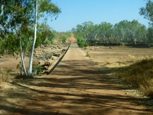
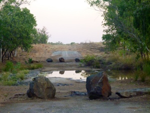
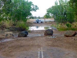
We leave crossing the bridge and see that the river is hardly a river if we look at the water it carries.
20120914-210526.jpg
In Western Australia they seem to recognise that as they only put “De Grey R” on signs. This seems a standard here. Of course it could also be a state wide saving program to minimize sign space.

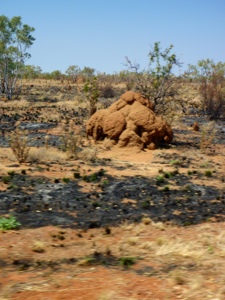
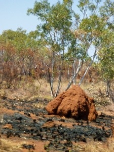
Some bored miners personalized ant hills with their safety helmets.

20120914-210851.jpg

And we came to the hustle and bustle of Port Hedland.
Mining traffic rules the world here.

20120914-211129.jpg

20120914-211141.jpg

20120914-211159.jpg

We decide to take fuel, stock up on groceries and have a beach stop. The beach is mining style with dumped sand and bits making the beach. The dogs don’t care.

20120914-211426.jpg

20120914-211439.jpg

20120914-211513.jpg
We pass the Port Hedland yacht club with three sorry boats stuck in a little water. I’m sure that boats are not a necessity to be part of the club.

20120914-211646.jpg

On the way to Cleaverville we pass the historic town of Roeburne.

20120914-212046.jpg

Then we follow 14 km of dirt road to arrive at a very dusty campground. The campground is mainly a strip of dirt along the coast with mainly people that stay three months of the winter season. There is not much attraction to us. No shower, no toilet, no water, barely beach (mostly rock) and mucky water. The sea breeze is nice though and we sleep well 🙂

Posted from Fortescue, Western Australia, Australia.

September 12, 2012

De Grey River

The Western Australians have an odd way of planning. Somehow they seem to not have realized that there is an ocean out west with scenic views, refreshing winds, cool waves. So they build the only road about 15 to 150 km inland from the coast. Ok, I get it that a main road not necessarily is constructed close to the beach, but at least at other parts of Australia (and the rest of the world) they construct some tourist road that provides access to the beach. Not here. The only access is over a long corrugated dirt road and that only where the local proprietor decided to rent out part of their property such as Barn Hill. These places are spread far apart. There’s a lot to grab for the smart town that develops themselves as a coastal place with easy access, places to stay, food to eat and beer to drink. Mmmmm, Axel Beach? Marjo Downs? Smagtville?

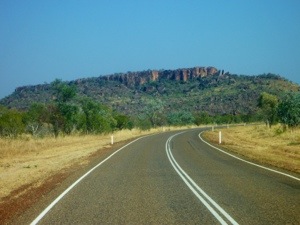
Enough pondering. Meanwhile we drive on, over monotone roads with quite a bit of mining traffic. Every second or third car is a road train with some mining equipment or something they dug up. This area has a lot of salt mining.

20120914-204403.jpg

20120914-205322.jpg

We both do a bit of driving and a little more till we are too hot and reach the nice rest area.

20120914-205902.jpg

20120914-205915.jpg

20120914-205928.jpg

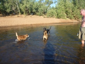
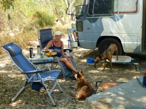
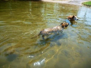
The dogs meet a friend while bathing and we prepare the shower.

20120914-210047.jpg

20120914-210101.jpg

20120914-210120.jpg

20120914-210131.jpg

For some a bath and a shower don’t help in getting clean.

20120914-210222.jpg

Apart from cows, bats and flies we get a visit from a small gecko duo.

20120914-210343.jpg

All in all a nice stay.

Posted from Cleaverville, Western Australia, Australia.

September 11, 2012

BroomeBarn Hill Station

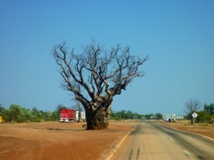
Escaping the heat and flies we leave early from this giant tree. The bus can smell the ocean and we continue west. We decide not to go to Derby but head straight for Broome and turn left at the if Boab tree.

20120911-170844.jpg

20120911-170857.jpg
When we get closer to Broome the air starts getting dense and before we know it we pass a large bush fire.

20120911-170350.jpg

20120911-170413.jpg

20120911-170435.jpg
Lucky for us this truck passed us just before.

20120913-195003.jpg
In Broome we find the ocean and the only beach where dogs are allowed looks like a parking lot.

20120911-162915.jpg
We decide to go off to the other side with nicer views and dip in the cool sea. Ahhhhhhhh, nice.

20120911-162956.jpg
Back at the car though we notice the stifling heat and the many flies. And the only camping in Broome that reluctantly accepts dogs is far from the ocean. I get a panic mode and feel stifled, claustrophobic. In a dash we get fuel, fill up with water see a little bit of Broome and then escape. In the rush we forget to do any grocery shopping but we can always live on lollies and dog food 🙂

We then pass the bush fire again and head south towards Port Hedland. In about 120 km there should be a seaside caravan park. We get a little tired and Marjo still feels that I rushed our Broome visit (which I did) but I need fresh air and water.

The scenery along the drive south changes with endless fields and snow? It works out to be white sand and also the ant hills that look like snow cones are pure white.

20120911-163553.jpg

20120911-163615.jpg
When we come to the turnoff for Barn Hill station, we are greeted by a fence and a 9 km corrugated dirt road.

20120913-194804.jpg

20120913-194821.jpg
The bus doesn’t like corrugation which means we don’t like it either and with 18 kph it takes exactly half an hour to reach the camping. It’s all worth it and we have a view, a breeze, bearable flies and a fabulous beach. Marjo’s in heaven.

20120913-195928.jpg
The beach combines rock and ocean with sand, stones, and a plethora of shells. We will leave many kilos heavier I’m sure.

We decide to stay three nights and enjoy sunsets and the sound of the waves (which is here a bit different as with every new wave a kaleidoscope of new pebbles, shells and other beautiful things wash ashore.

20120911-163058.jpg

20120911-163107.jpg

20120911-163133.jpg

20120911-163122.jpg
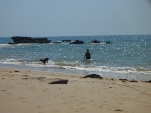
The dogs love the freedom of the beach and frolic in the water, cool down in pools and sleep in the shade.

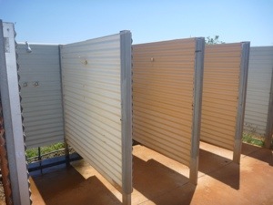
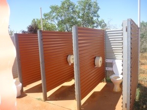
We love the layout of the amenities. The warm water for the showers depends on the sun heating up the black pipes, so an early morning or evening shower is a frightening cold affair. And before you go to the loo you need to look up to make sure no passing bird poops on you while you’re busy yourself 🙂 You also get interesting results peeing at night and gazing at the stars…..nobody likes wet feet.

20120913-195223.jpg

20120913-195230.jpg

20120913-195235.jpg
Then we really run out of food and move on.

Posted from Roebuck, Western Australia, Australia.

September 10, 2012

Barn Hill beach

The visual stimulation at this beach is too much for words. Enjoy!

20120913-200034.jpg

20120913-200125.jpg

20120913-200208.jpg

20120913-200238.jpg

20120913-200317.jpg

20120913-200343.jpg

20120913-200423.jpg

20120913-200437.jpg

20120913-200500.jpg

20120913-200533.jpg

20120913-200616.jpg

20120913-200716.jpg

20120913-200818.jpg

20120913-200831.jpg

20120913-200906.jpg

20120913-201045.jpg

20120913-201115.jpg

20120913-201125.jpg

20120913-201310.jpg

20120913-201320.jpg

20120913-201331.jpg

20120913-201405.jpg

20120913-201438.jpg

20120913-201451.jpg

20120913-201521.jpg

20120913-201559.jpg

20120913-201612.jpg

20120913-201631.jpg

20120913-201707.jpg

20120913-201718.jpg

20120913-201753.jpg

20120913-201800.jpg

20120913-201807.jpg

Then I try to get Nossi for a last swim:

20120913-201933.jpg

20120913-201942.jpg

20120913-201948.jpg

20120913-201953.jpg

20120913-201958.jpg
And Dotti enjoys the spectacle.

20120913-202041.jpg

20120913-202313.jpg

20120913-202321.jpg

September 8, 2012

Boab rest area

The scenery is becoming less hilly and more plain. That’s a pity as many kilometers with shrubs and termite mounds gets boring pretty fast.

Then we see a viewpoint and stop for a dog pee and scenery.

20120912-143652.jpg

20120912-143700.jpg

20120912-143728.jpg
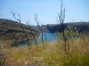
Our next stop is at Fitzroy Crossing for some fuel and then Marjo sees a sign for Geiki Gorge, the only attraction in the Kimberley’s that is accessible without 4WD. It is not bad but we are quite a bit disappointed about what there is to see from the Kimberley’s through the Great Northern Highway. If you ever decide to “do the Kimberley’s” make sure you can see it via the Gibb River road (dirt).

20120911-170023.jpg

20120911-170034.jpg

20120911-170048.jpg

20120912-143318.jpg
Looking at these pictures there seems to be an “ebony and ivory” effect.

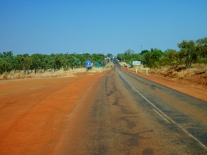
We follow the endless road.

20120912-143952.jpg
And Nossi enjoys the view from the back.

20120912-144005.jpg

Then we come to a rest area where people sit with fly nets over their head and where there is no shade. We do a short tour and decide to move on, another 90 km to the Boab rest area. This better be good. And it was!

20120912-144238.jpg

20120912-144450.jpg

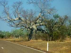
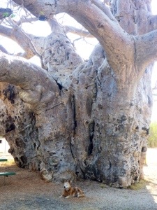
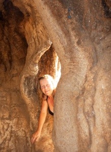
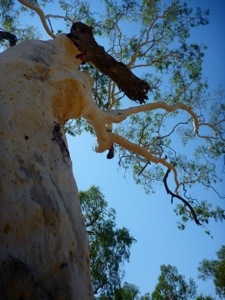
The tree must have been formed over years from a circle of trunks and then grown together. Now it’s hollow and Nossi is curious.

20120912-144624.jpg
And then wants to run when he sees me there.

20120912-144723.jpg
Marjo is more interested to join me.

20120913-191812.jpg

20120913-191828.jpg

20120913-191855.jpg

20120913-191911.jpg

Posted from Roebuck, Western Australia, Australia.

September 7, 2012

Mary river

We woke at 5.30 am which in NT time is only 7 am. The sun clearly hasn’t changed it’s clock because at 5.30 am you can already feel the heat increasing. So we have early breakfast and before 8 am we’re on the road.

We stop to check for some suspect sound but find everything in order and the alternator is still with us. You can’t be careful enough though.

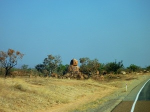
Then we stop for some nice views and take some more photos of termite mounds. They are pieces of art!

20120911-160403.jpg

20120911-160412.jpg
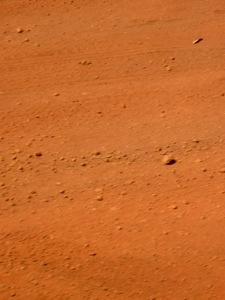
We stop for fuel at Halls Creek and get dazzled by the fierce redness of the soil.

20120911-160211.jpg

20120911-160220.jpg
At the Information booth we ask if we can swim at Mary Pool.The answer is “if there’s any water there then you might”. The question “Are there no crocs” is answered with “well there could be”. So we decide to drive on to Mary pool anyway.

20120911-160459.jpg

20120911-160635.jpg
The rest stop is nicely positioned off the road with plenty of shade. Not much water though, so the question of swimming is premature. We do some drawing (Marjo), fixing (Axel) and rolling in the dust (Dotti) and making funny noises at passing cows (Nossi). The wind is nice and refreshing and we are happy.

20120911-160609.jpg

20120911-160621.jpg

20120911-160856.jpg

Posted from Mueller Ranges, Western Australia, Australia.

September 6, 2012

Turkey Creek

With a disturbed sleep at night, I can’t wake up very well in the morning and Marjo is so sweet to make breakfast. We lazy a little and then pack up to do shopping, take in fuel and look around in Kununurra.
We stop at a zebra stone gallery and Marjo decides she doesn’t like that unique Kununurra stone but instead she gets a piece of Liesengang Weatherrock, with warm red and yellow colours. Meanwhile we enjoy the animal life around the gallery.

20120911-111407.jpg

20120911-111522.jpg
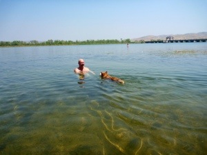
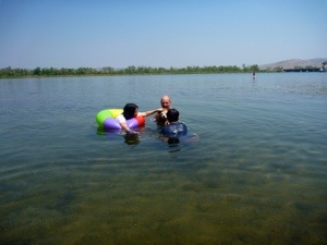
Then we go to a swimming beach in the Kununurra lake that forms an extension of Lake Argyle. Some Japanese tourists that happen to float there too are smitten by the dogs and have photo sessions whilst continuously repeating their names “Dotti”, “Dotti”, “Dotti”, and “Nossi”, “Nossi”, “Nossi”. Having endured that, we refused to give them our names 🙂

20120911-111645.jpg

20120911-111711.jpg

20120911-111720.jpg

20120911-111728.jpg
At the campground we forgot to fill up with fresh water so we tour town to look for a tap. We follow the two signs for “free coffee for driver” until they stop putting them up and see no free coffee or tap. Then at the sports grounds some builder is using water and we borrow his hose to fill up (his water hose).

Then we are on our way west again.

20120911-112259.jpg

20120911-112321.jpg

20120911-112247.jpg

20120911-112220.jpg
We are planning to camp near the Orb river but see a spot before that with a little water and some shade. We pull into the stop at an old river crossing and park on the road. Sooooo many flies though.

20120911-112748.jpg

20120911-112802.jpg

20120911-112813.jpg
It being only 100 km south west of Kununurra the temperature is distinctly better. At night it drops to 15! degrees. Nice! At some point it is cool enough to go inside and watch some Bones on our iPads.

Oh, no turkeys in the creek though.

Posted from Mueller Ranges, Western Australia, Australia.

September 5, 2012

Hidden valley Kununurra

Also this one got wiped by our great blog app……so take 2:

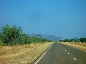
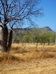
After packing up and making sure the alternator is where it’s supposed to be we leave without a hitch and take the winding road between mountains and passing more Boab trees.
20120911-101811.jpg

20120911-101828.jpg

20120911-101859.jpg

20120911-102005.jpg

20120911-102020.jpg

Then at 10.45 am we reach the border between Northern Territory (NT) and Western Australia (WA) which for the first time is a real controlled border.

20120911-102642.jpg
We have to pull over and declare some potatoes as we couldn’t decide whether they were veggies or fruit. The guy didn’t care and we had to throw it out as well as the carrots and cauliflower we were planning to eat during the morning trip. After some inspection of the bus and trailer we were through. Marjo let out a sigh of relief as she was afraid they would confiscate her seed pots (no seeds), her rocks (no bugs) or red sand (nothing but sand).

I hear you ask: “so, what’s different in WA?” and we are prepared for just such a question:
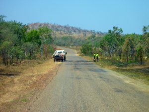
– it feels like we’re thrown back in time. Not only is road repair here by the bucket as we saw in QLD.
20120911-113601.jpg
But also the clock is turned back 1 hour and thirty minutes. So suddenly it’s 9.15 am!
– the cattle here seems to like to highway better than their paddocks

20120911-113837.jpg
– people are better off than in NT or there’s better security as the roadside solar panels are still in place

Then we take the turnoff to Lake Argyle, a man made land sea the size of 18 times Sydney Harbour (which seems to be a generally accepted means of measure of water bodies in Australia). The drive to the lake and the lake itself are stunning.

20120911-104906.jpg

20120911-104949.jpg

20120911-105022.jpg

20120911-105043.jpg

20120911-105108.jpg

20120911-105147.jpg

20120911-105210.jpg

20120911-105220.jpg

20120911-105246.jpg

20120911-105302.jpg

20120911-105310.jpg

20120911-105326.jpg

Then we stop for lunch on a field with real grass. I can’t describe how nice it feels to have real juicy grass under your toes, the green lush leaves tickling your foot soles, the smell of the moist, the green colour. Ah well, you get the picture.

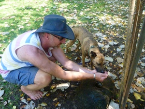
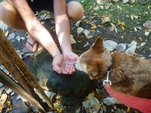
Nossi and Dotti drink some water and Marjo shoots some interesting tree which seems to have orchids growing in them.
20120911-105808.jpg

20120911-105816.jpg

20120911-105826.jpg

20120911-105833.jpg
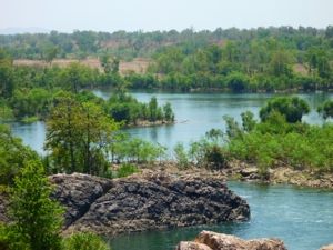
Then we find some water for the dogs to cool down in and they gladly accept.

20120911-105927.jpg

20120911-105940.jpg

20120911-105949.jpg
And it becomes time to go onto Kununurra for some shower, washing and shopping.
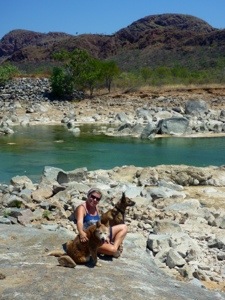
We stop to see if the river is nice, but it works out that the water has inaccessible high edges and weed cover where unpleasant animals could be lurking. It is lunchtime after all.

20120911-110325.jpg

20120911-110341.jpg

Then after some more views we come to Kununurra, go to the Hidden Valley camping and find a spot between many many tent campers. It seems that this is the camping where the French go when they leave their country as all we hear is cackling French young man and women. And it never stops 🙂 On the drive, Dotti feels all rested and happy.

20120911-111023.jpg

20120911-111032.jpg
While Marjo takes up the vibe, I do some well needed laundry and soak in the pool (very nice cold and shady). Then it’s Marjo’s turn.

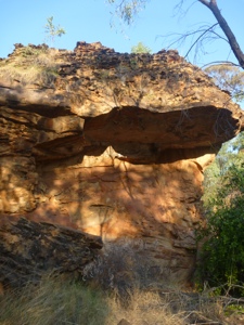
Later on she goes for a wander around the Merima National Park that starts at the camping back fence.
20120911-110757.jpg

20120911-110836.jpg

20120911-110903.jpg
That night we did not get a lot of rest. The French keep at it, keeping Marjo listening and I get woken up by some animal in a tree that seems to imitate an alarm, 15 second beeps on, 3 seconds off. 15 seconds on, 3 seconds off, 15 seconds on, 3 seconds on, ………

Posted from Kununurra, Western Australia, Australia.

September 4, 2012

East Baines River

Soooooo….there was a whole story here, all typed up off-line. Bloody technology erased it all when we got internet reception, so take 2:

We woke up a bit later, at around 7.45 am and had breakfast. Nossi got his Valium to prepare him for the trip and we packed up. After checking that the alternator is still hanging on we hit the road.
A doped up dog works well when traveling 🙂

20120906-092157.jpg
And as always, Dotti travels easily and seems to enjoy the ride.

20120911-094527.jpg

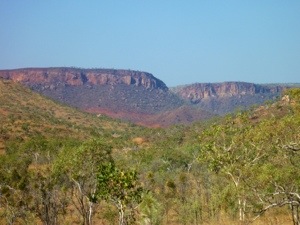
Then the scenery starts to get interesting with more mountains. Oh, there is a bit of a warning here: if you’re a surfer dude or girl and not so much into mountains, then I suggest you take that short holiday you always wanted to have ‘cuz theres gonna be a whole lot of mountain pics’. Marjo loves them and she controlled the camera. I must say they turned out nice and there are some nice views here.
To give you a sample:

20120906-092539.jpg

20120906-092543.jpg

20120906-092550.jpg

20120906-092555.jpg

20120906-092602.jpg

Also, since we hit Katherine, rivers start earning their name and actually show water:

20120911-094002.jpg

We now start seeing some other vegetation, such as the nice Coolibah tree which has a nice branch structure whether with or without leaves.

20120911-094114.jpg

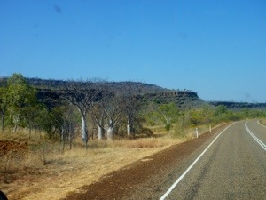
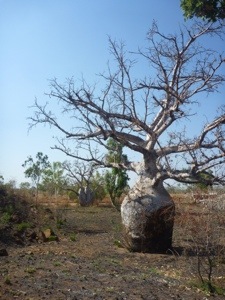
Then more mountains and even Boab trees. Not the single one with a sign such as in Katherine, but thousands of them. Very interesting looking tree.

20120911-094256.jpg

20120911-094305.jpg

20120911-094411.jpg

20120911-094419.jpg

20120911-094432.jpg
We pull quite early into a nice road stop and find a spot with some shade. Then someone left, leaving a much larger shady area, which comes at a premium on 38 degree days. So we move camp and set up in the shade. Then we find out what bull dust is: thick and very fine red dust that, with every step you take, engulfs your foot and leaves a little puff cloud. The dogs and everything turns dusty red and becomes a mess.
So when the sun set, we move again. Three sites at the same rest area. Luckily there are not many people there. Then we have a little dried dirt with some dried flat vegetation. We hook up Marjo’s bush shower back and all take our turn hosing off the hot dust.

Because this is our last night in Northern Territory, Marjo gets all organized and wants to prepare our cavity search. It is not allowed to enter Western Australia with anything that can bring in unwanted bugs. So we had a very healthy day with lots of fruit and veggies. Also Marjo dived deep into the honeypot and I cracked some nuts.

20120911-095445.jpg

20120911-095453.jpg
Can’t remember exactly where we found the macadamia nuts but now, many weeks later drying in the sun on our dashboard, they seem very edible. Nice even!

Posted from Baines, Northern Territory, Australia.

September 3, 2012

Limestone Creek

Although we liked the Lazy Lizard, we can feel the heat and want to move on. We have some business in Katherine and then want to turn West.
The early sun and quick heat makes that by 8 am we’re washed and fed outside to start packing up, feeding the dogs, walking the dogs, dumping the black water and filling the fresh water. So before 9 we’re on the move.

We drive over known roads again, the 300 km back from Litchfield to Katherine and at around 10 am, just before the Katherine campus of the Charles Darwin University the same problem occurs. The alternator drops off. Several hot moments, curses, black smears later we are on the road again, 20 km from Katherine. We pull into the vet that we saw the last time we were in Katherine to get repeat prescriptions for Dotti and then they had to check with our Sydney vet. They still hadn’t done that by now so Marjo put a little pressure on and within an hour we had what we needed. Somehow when it involves pets, the medical professionals seem to be much more strict (and/or chasing money) than with humans. But hey. We have what we needed so we move on. Some shopping at Woolies and new wine for Marjo. Oh no, it is before 2 pm and someone in their wisdom has decided that drinking before 2 pm is not good so no wine. Then the next stop is fuel and new gas. We had to split that in two stops because the first fuel station had no full swap gas bottle. The second only refilled but by now the attendant was gone out for lunch so the cash lady took our money and asked to wait till he returned. Meanwhile we were cooking ourselves in the 36 degrees. That out of the way we returned to the mechanic that serviced our car. When he serviced it before I asked him to check for all loose bolts. He said he did so I wondered how the alternator could have fallen off again. He didn’t know and said, book it in for tomorrow and we’ll have a look. I didn’t want to wait though so asked Tom, the owner. He put the bus in the garage and together we put new bolts in with locktite. Also tensioned some other bolts.

By then Marjo and the dogs were almost melted while waiting outside. So we decided to drive back to the east of Katherine to go to Knotts Crossing where I was a few days before. We all had a nice time and cooled down.

20120906-085506.jpg

20120906-085513.jpg

20120906-085517.jpg

20120906-085522.jpg

Then we drove back to Katherine for wine (by now it was 3.30 pm) an ice cream from McDonalds and then on, finally west. We had not gone west since we left Barkly Homestead after Marjo’s birthday, a bit over 2 weeks ago.

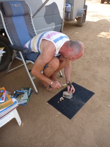
We did 60 km’s and then pulled over at a road stop for the night, next to a couple who had been traveling in their Nissan bus 6 years. After dinner he came over and asked “can I look at your rear, Axel?” at which Marjo looked puzzled. I had no qualms though and said: “sure, do you need a light?” and proceeded to look with him under the bus. He needed new shocks for his bus and could only get Toyota shocks and wanted to see how they were mounted on the back axle. Later on Marjo wondered how the guy knew my name. I puzzled what she meant as I hadn’t told them my name. The next morning it dawned on me that he had said “axle” instead of “axel” 🙂

Posted from Baines, Northern Territory, Australia.